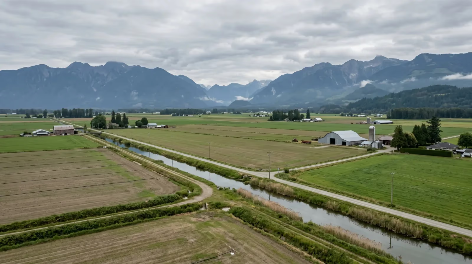

For years, "is this home in a floodplain?" was a question most Fraser Valley buyers never asked. The November 2021 floods changed that, and the FRIVE team gets the question on almost every rural or agricultural-area search now. Those events put flood risk on every buyer's radar, and rightly so, but the right response isn't fear, it's a small amount of homework. The vast majority of homes in the region are nowhere near a floodplain. Some are. Knowing which is which, for a specific property, is now part of buying well.
This is a calm, practical guide to checking flood risk before you buy. It's general information, not professional advice; for any property with potential flood exposure, get your insurance broker and lawyer involved.
What happened in 2021, briefly
In mid-November 2021, an atmospheric river brought intense rainfall to the region. The Nooksack River overflowed, and floodwaters moved north into Sumas Prairie in Abbotsford, an area that was historically a lake (Sumas Lake), drained in the 1920s for farmland. Dikes were breached, over 1,100 properties and thousands of people were evacuated, and the damage was severe (City of Abbotsford). It became one of Canada's most significant flood events.
That history matters for two reasons. It shows that flood risk in the valley is real and concentrated in specific low-lying areas. And it shows why those areas are vulnerable, Sumas Prairie sits where a lake used to be, below the surrounding land. The risk isn't random; it follows the geography.
Risk is per-property, not per-city
Here's the thing to keep in mind, because it's where people overreact in both directions. Flood risk in the Fraser Valley is highly location-specific. Much of Surrey, Langley, and Abbotsford sits on higher ground with little flood risk. Specific low-lying areas near the river systems carry more. You can't judge a property's flood risk from the city it's in, you assess it for the individual address.
So the 2021 floods don't mean avoiding Abbotsford, or the Fraser Valley generally. They mean checking the specific property. A condo on higher ground in central Abbotsford has a completely different risk profile than an acreage on Sumas Prairie. Treating the whole region as risky is as wrong as ignoring the risk entirely.
How to actually check
The good news is that flood risk, unlike a leaky roof, is something you can research before you ever remove subjects, and it's not visible at a showing on a sunny day, so you have to look it up deliberately.
Start with floodplain mapping. Municipal and provincial floodplain maps show which areas are designated flood-prone (Government of British Columbia). You can consult these, ask the municipality directly, and have your lawyer look into the specific property's status. For any property near a river, in a low-lying area, or with visible drainage concerns, this check is essential before you commit. Our guide to subject removal explains how your conditions give you time to do this kind of investigation.
Beyond Sumas Prairie: the Fraser River corridor
Most buyers who've heard about the 2021 floods immediately think of Sumas Prairie. That's appropriate, it was the most severely affected area. But the broader question of flood risk in the valley extends further, and it's worth understanding the bigger picture before assuming "not Sumas Prairie" means "no flood concern."
The Fraser River runs through the heart of the valley, and its floodplain touches parts of Mission, Maple Ridge, and communities further west. The Fraser's 200-year flood level covers meaningful areas along its banks, and large stretches of riverside land are diked rather than sitting above the flood level naturally. Diked areas are protected in normal conditions, but protection through a dike is different from elevation above the flood level.
Here's a scenario we've had come up in Mission. A buyer purchases a townhouse in a low-lying part of town, close to the river. The neighbourhood looks fine, it's established, it's residential, and there's no obvious sign of flood history. What the buyer didn't check was whether the street sat within the floodplain zone behind the Mission Perimeter Dike. It does. That fact changes both the insurance conversation and the resale picture. The home wasn't in Sumas Prairie and didn't flood in 2021, but it sits in a managed-risk zone. The buyer found this out from their insurance broker when getting quotes, not from the listing.
The practical question for any property near the Fraser River, or near a tributary, isn't just "did this flood in 2021?" It's "is this property above the flood construction level, or is it in a diked area?" Those are two different situations, and they require different due diligence conversations. Ask your realtor, ask the municipality, and get a clear answer from your insurance broker before subjects come off.
What flood insurance actually costs and covers
Flood risk and insurance are tightly linked, and this is where it gets practical for your budget and your financing.
Standard home insurance doesn't automatically cover overland flooding, water entering from rivers, overflow, or heavy rain pooling at ground level. Overland water coverage is often a separate, optional add-on, and in higher-risk areas it may be limited, expensive, or unavailable. So for any property with potential flood exposure, confirm with an insurance broker what coverage is available and what it costs. Our piece on water damage and strata insurance covers the strata-insurance side, but for flood specifically you want a clear answer on overland coverage.
This also touches financing. Lenders generally require adequate insurance, so a property that's hard or costly to insure against flood can complicate both the mortgage and ownership. Confirm insurability early, it's not a detail to leave until just before completion.
Here's a scenario that illustrates why timing matters. A buyer makes an accepted offer on a property near the river in a known flood-risk corridor. They remove the inspection condition on time and plan to sort out insurance later. When they finally call an insurance broker a week before completion, they discover that overland flood coverage is not available for that specific address from any of the major carriers. Without that coverage, their lender has concerns about the insurance meeting requirements. What could have been a simple "is this property insurable and at what cost?" question, answered in two phone calls during the subject period, becomes a scramble in the final week. Get the insurance quote before subjects come off, not after.
Dikes reduce risk, they don't eliminate it
For buyers in diked areas, which includes parts of Mission, Maple Ridge, Richmond, and Sumas Prairie itself, understanding what "protected by a dike" actually means is important.
Dikes significantly reduce flood risk by holding back water that would otherwise reach properties. Without the dike system, large parts of the lower mainland would be at substantially higher risk. The dikes are real infrastructure, regularly maintained (or meant to be), and they work most of the time.
But dikes also fail, as the 2021 event demonstrated. Dike failures happen through overtopping (water rises above the dike crest), seepage (water moves through or under the dike), or structural failure. A dike that is well-maintained and designed to handle a 200-year flood event provides meaningful protection. A dike that is aging, under-engineered for today's precipitation patterns, or not regularly inspected provides less.
The question for a buyer in a diked area isn't only "is there a dike?" It's more nuanced than that: what is the dike designed to handle, how recently was it inspected, and is it in good condition? Municipalities often have inspection records available through their engineering departments. Your realtor can help you find out which authority maintains the dike protecting a specific area and whether there's publicly available information on its condition. The BC government's flood risk and floodplain mapping page is a starting point for understanding provincial context, but the specific dike protecting a specific street may be a municipal responsibility.
We're not suggesting that buyers in diked areas should panic. Plenty of people live well in diked communities and the risk is genuinely managed. The point is to go in with eyes open: you're in a managed-risk zone, not a zero-risk one, and knowing that changes both your insurance conversation and your long-term thinking about the property.
Keeping it in perspective
It would be easy to read all this and become anxious about flooding everywhere. Don't. For the great majority of homes a first-time buyer in the Fraser Valley will consider, flood risk is low, the floodplain check comes back clean, and standard insurance plus reasonable coverage is straightforward. The point of the check isn't to find a reason to worry, it's to confirm, quickly and early, that there's nothing to worry about, or to know exactly what you're taking on if there is.
The properties that genuinely warrant extra care are the specific low-lying, flood-prone ones, and Sumas Prairie is the clearest example. It's a known flood-prone area with a history of flooding, and flood mitigation has been an ongoing public matter since 2021. That doesn't make it impossible to buy there, but it does make careful research into the current flood protection, the specific property's risk, and insurance availability essential, with professional advice. It's a case for more due diligence, not a blanket no.
The takeaway
After 2021, flood mapping belongs in your standard due diligence, right alongside the inspection and the strata documents. Check the property's floodplain status, ask the municipality, confirm overland water insurance availability and cost with a broker, and have your lawyer review the relevant information. For most homes it's a quick, reassuring check. For the few in flood-prone areas, it's the difference between a knowing decision and an expensive surprise.
If you want help checking flood risk on a property you're considering, reach out to the FRIVE team, we'll point you to the right mapping and the right questions for your broker and lawyer, or browse current Fraser Valley listings to start your search.
Frequently asked questions
Is the Fraser Valley at risk of flooding?
- Parts of the Fraser Valley sit in low-lying areas near the Fraser and other river systems and have flood risk, while much of the region is on higher ground with little. The November 2021 atmospheric river caused major flooding in low-lying areas like Sumas Prairie in Abbotsford. Risk is very location-specific, so it's assessed per property, not per city.
What happened in the 2021 Fraser Valley floods?
- In mid-November 2021, an atmospheric river brought intense rainfall. The Nooksack River overflowed and floodwaters moved into Sumas Prairie in Abbotsford, historically a lake that was drained in the 1920s, leading to dike breaches, the evacuation of over 1,100 properties and thousands of people, and major damage. It was one of Canada's most significant flood events.
Sources
- Flood Response & Recovery, City of Abbotsford, City of Abbotsford
- Flood risk and floodplain mapping, Province of British Columbia, Government of British Columbia
Related guides
- Buyers GuideBC Home Buyer Rescission Period: The 3-Day Rule First-Time Buyers Need to Know
- Buyers GuideSubject Removal in BC Real Estate: What It Is and How It Works
- Buyers GuideSteps to Buying a Home in Langley, BC: A First-Time Buyer's Guide
- First-Time BuyersBaseboard Heat vs Heat Pump: What Fraser Valley Condo Buyers Should Check
Found this useful? Share it.
A neighbour, a partner, a friend who's two FHSA contributions away, send it their way.